
Informing Land Management Leaders
Land management leaders are transforming the future of our food systems and the ecological efficiency of working lands.
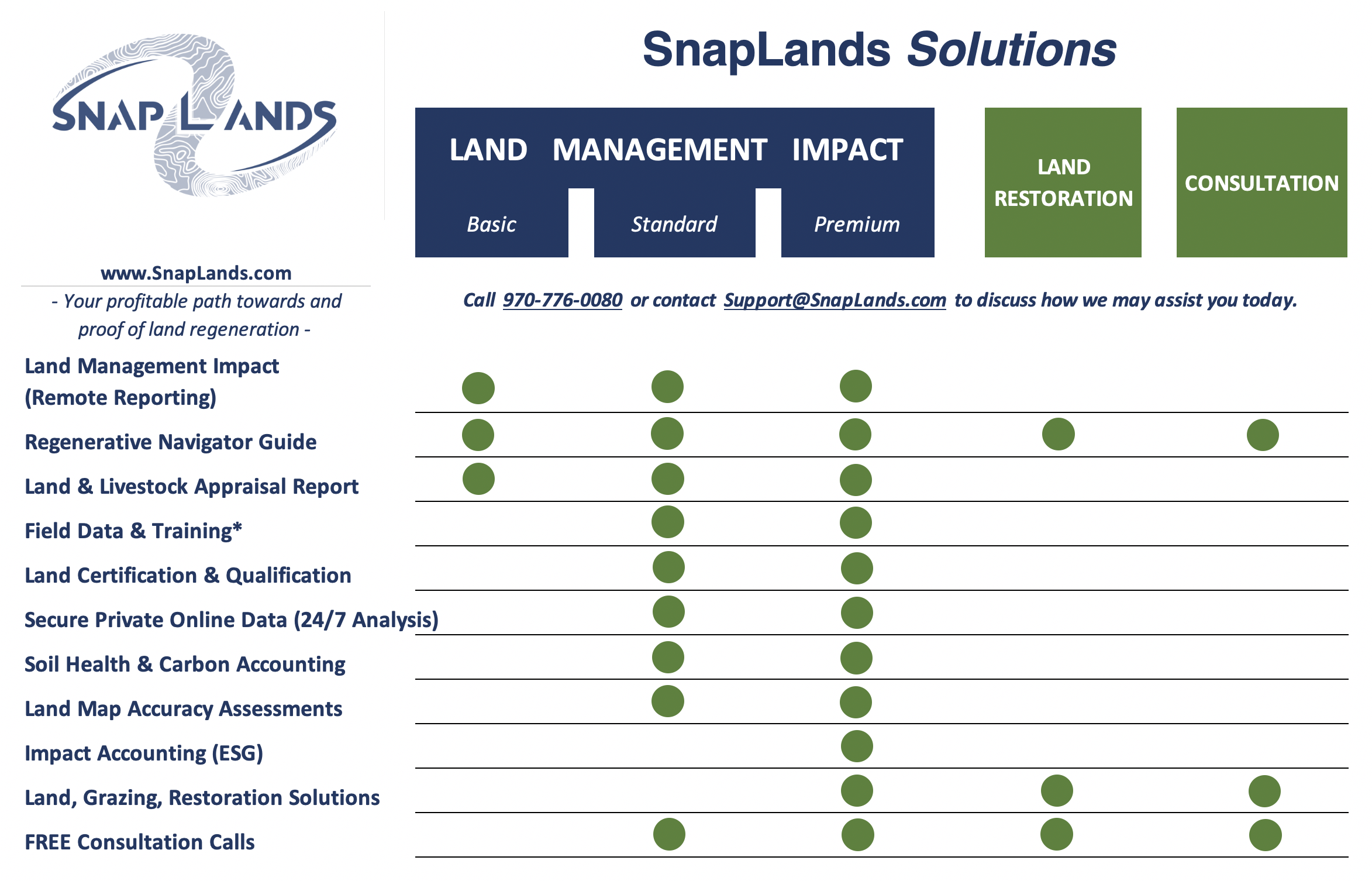
Our solutions span from full-service land restoration project management to DIY monitoring and planning tools—designed for real-world decisions on real landscapes.
Millions of acres are advancing both food production and ecological resilience each year through the Land Management Impact Program—a practical, visual, and management-ready system for continuous land improvement at scale.
Join the movement. Think, plan, and act like the land leaders shaping the future.
Turn expert insights and remote sensing into your actionable land health strategies that drive your business towards trusted results, straight from the land.
Our working lands solutions offer the following:
◉ Maximize Ranch Working Lands Production & Resiliency Discover key business opportunities and trends. Get management-ready grazing plans and adaptive land feedback. Meet with active managers about your 100% landcover maps, graphs, & imagery
Ask about: Land Management Impact™, Land EKG™ & Land CPR™
◉ Verified Outcomes for Impact Reporting & Assets
Ask about: Land Management Impact™
◉ Soil Health management, monitoring, accounting & validation
Ask about: Land EKG™, 3rd-Party Verification, DataStore™
◉ Land & Livestock Data Management Accounting Cross-Cutting Data Lake Sovereignty and Solutions
Ask about: Land EKG™, 3rd-Party Verification, DataStore™
◉ Regenerative Impact & Training Education Accreditation, Corporate Consultation, Impact Investing, Research, Certification, Workshops & Public Speaking
Ask about: Land EKG™, Land CPR™, EverSoil™, EOV
Get simple, cost-effective tools to reveal where and when land health conditions and trends are at local and regional scales. We’ve flipped land surveillance strategies in to service working land leaders in their industry.
We’re glad to share and learn more about your operation today. Click below for a quick discovery call!